
Global Positioning System (GPS) and Global Navigation Satellite System (GNSS) have revolutionized the way we navigate and perceive space. Initially developed for military purposes, GPS has now become an indispensable tool in various civilian applications, ranging from mapping and transportation to agriculture and outdoor recreation. In this article, we will delve into the workings of GPS and GNSS technology, explore their applications beyond traditional mapping, and discuss the future trends shaping their evolution.
Understanding GPS and GNSS
GPS is a satellite-based navigation system that provides location and time information in all weather conditions, anywhere on Earth. It consists of a constellation of at least 24 satellites orbiting the Earth, transmitting precise signals to GPS receivers on the ground. These receivers then use trilateration to determine the user’s precise location by measuring the time it takes for signals to travel from the satellites to the receiver.
GNSS is a broader term that encompasses various satellite navigation systems, including GPS (USA), GLONASS (Russia), Galileo (European Union), BeiDou (China), and NavIC (India). Each of these systems operates independently but interoperates to provide global coverage and enhance accuracy. By leveraging multiple GNSS constellations, receivers can obtain more accurate positioning information, especially in challenging environments like urban canyons or dense foliage.
Applications of GPS and GNSS Technology:
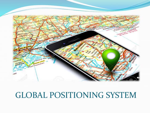
- Mapping and Navigation:
- GPS-enabled devices such as smartphones and car navigation systems provide real-time navigation assistance, helping users find directions, locate points of interest, and plan optimal routes.
- Mapping applications like Google Maps and Apple Maps utilize GPS data to display detailed maps, satellite imagery, and traffic information, facilitating efficient travel and exploration.
- Precision Agriculture:
- Farmers use GPS technology to precisely monitor and manage agricultural activities, including planting, irrigation, fertilization, and harvesting.
- Tractor guidance systems equipped with GPS enable farmers to optimize field operations, reduce input costs, and increase crop yields by minimizing overlaps and gaps.
- Fleet Management:
- Logistics companies and transportation providers rely on GPS tracking systems to monitor vehicle movements, optimize routes, and improve delivery efficiency.
- Real-time vehicle tracking enables fleet managers to enhance driver safety, prevent unauthorized use, and respond promptly to emergencies or delays.
- Outdoor Recreation:
- GPS-enabled devices like handheld GPS units and smartwatches are popular among outdoor enthusiasts for activities such as hiking, camping, geocaching, and mountain biking.
- These devices provide accurate location information, trail maps, elevation data, and navigation cues, enhancing safety and enjoyment in remote wilderness areas.
Beyond Traditional Applications: While GPS and GNSS technology have already transformed various industries, their potential goes beyond traditional mapping and navigation. Here are some emerging and innovative applications:
- Autonomous Vehicles:
- Self-driving cars rely heavily on GPS and GNSS technology for precise positioning, mapping, and localization.
- High-accuracy GNSS receivers, coupled with advanced sensors and algorithms, enable autonomous vehicles to navigate complex urban environments safely and efficiently.
- Augmented Reality (AR) and Location-based Services (LBS):
- AR applications use GPS data to overlay digital information onto the user’s physical surroundings, creating immersive experiences and enhancing situational awareness.
- Location-based services leverage GPS positioning to deliver personalized content, recommendations, and advertisements based on the user’s current location and preferences.
- Disaster Management and Emergency Response:
- GPS plays a critical role in disaster preparedness, emergency response, and search-and-rescue operations.
- First responders use GPS-equipped devices to coordinate efforts, locate victims, establish safe evacuation routes, and assess the impact of natural disasters such as earthquakes, floods, and wildfires.
- Environmental Monitoring and Conservation:
- GPS tracking devices are used to monitor wildlife movements, track endangered species, and study habitat utilization patterns.
- Conservationists utilize GPS data to identify biodiversity hotspots, enforce wildlife protection measures, and mitigate human-wildlife conflicts effectively.
Future Trends and Challenges: As GPS and GNSS technology continue to evolve, several trends and challenges shape their future trajectory:
- Enhanced Accuracy and Reliability:
- Advances in receiver technology, signal processing techniques, and satellite constellations will lead to higher positioning accuracy and reliability.
- Augmentation systems like Differential GPS (DGPS) and Real-Time Kinematic (RTK) positioning will further improve precision in critical applications such as aviation, surveying, and autonomous navigation.
- Integration with Emerging Technologies:
- GPS and GNSS will increasingly integrate with emerging technologies such as 5G networks, Internet of Things (IoT) devices, and Artificial Intelligence (AI) algorithms.
- This integration will enable seamless connectivity, enhanced data analytics, and intelligent decision-making across diverse sectors, from smart cities to precision agriculture.
- Cybersecurity and Resilience:
- With growing reliance on GPS for critical infrastructure and services, cybersecurity threats such as spoofing and jamming pose significant risks.
- Addressing these threats requires robust encryption, authentication mechanisms, and resilient backup systems to ensure the integrity and availability of GNSS signals.
- Regulatory and Policy Considerations:
- International cooperation and coordination are essential to address regulatory issues, spectrum allocation, and standardization of GNSS signals and services.
- Policymakers must balance the need for security, privacy, and open access to GNSS data while fostering innovation and economic development.
Conclusion
GPS and GNSS technology have transformed how we navigate, communicate, and interact with the world around us. From mapping and transportation to agriculture and emergency response, their applications are diverse and far-reaching. As we embrace emerging trends and overcome challenges, the future promises even greater integration, innovation, and impact across various sectors. By unlocking the full potential of GPS and GNSS technology, we can navigate towards a more connected, efficient, and sustainable future.